D'Olive Watershed Model for Restoration
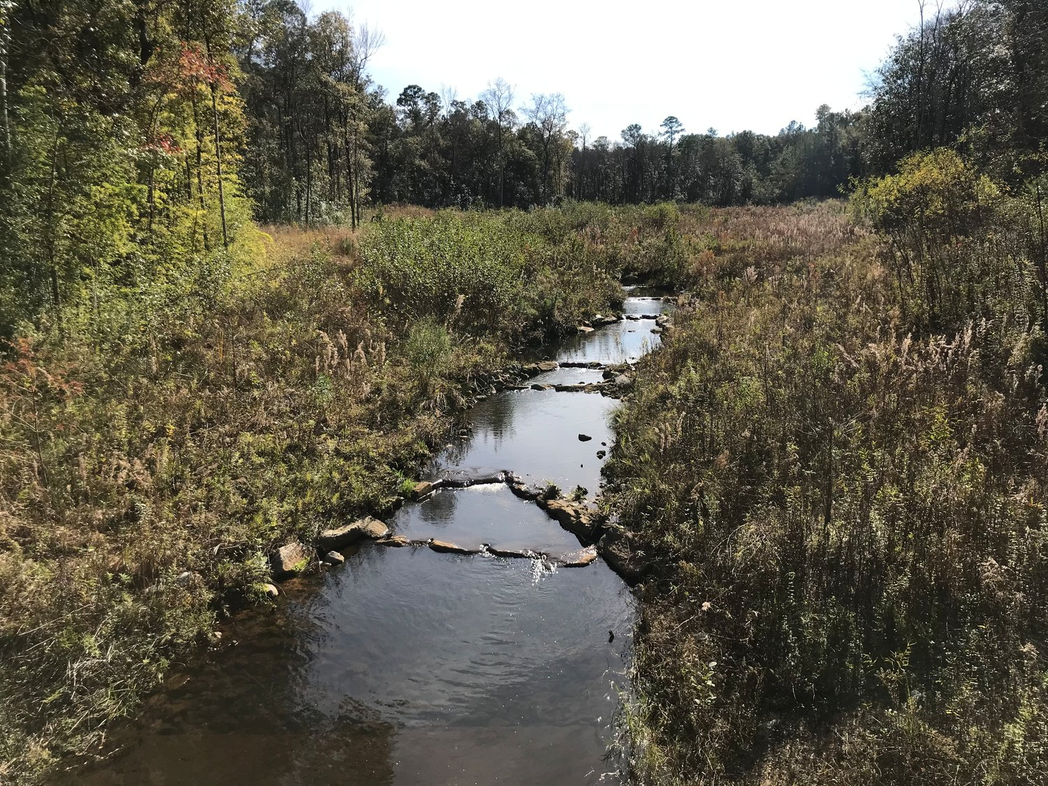
Tiawassee Creek in Lake Forest is one of the waterways in the D'Olive Creek watershed restoration project.
By Guy Busby
DAPHNE – A decade after the heavily eroded D’Olive Creek area was “the Grand Canyon of Baldwin County,” the watershed is now being cited as an example of how stream restoration can control erosion and soil flowing into waterways.
During a recent workshop on watershed restoration, engineers, officials and environmental experts looked over areas in the 7,700-acre D’Olive Creek basin that also includes Joe’s Branch, Tiawassee Creek and other tributaries. Where gullies had been cut 20 feet deep in some places, the water flowed over rocks past banks covered in natural vegetation.
“This was the Grand Canyon of Baldwin County,” Greg Jennings, a consultant for the Mobile Bay National Estuary Program.
The Mobile Bay NEP was one of the organizers of the Gulf Coast Watershed Sustainability Workshop held Dec. 3 and 4 in Daphne.
For years, erosion had been a major problem along the creeks in the Daphne, Spanish Fort area. Runoff from construction of subdivisions, roads and shopping centers as well as other sources were major factors in the erosion, organizers said.
Marlon Cook, a hydrological consultant and who is retired from the Geological Survey of Alabama, said that along Joe’s Branch, more than 100,000 tons of sediment was being washed away each year. He said in a recorded statement played at the workshop that he was not aware of that much sediment being carried by any stream.
That eroded soil ended up downstream. The lake at Lake Forest subdivision was being filled in to the point that homeowners who once had waterfront property now had docks extending into swampy wetlands, Ashley Campbell, Daphne environmental programs manager, said. Sediment has clogged the channel near the city’s D’Olive Bay boat launch to the point that Daphne recently received an $800,000 grant to dredge the waterway.
About five years ago, the Mobile Bay NEP, local governments and other organizations began work to cut back on erosion and sedimentation. While some efforts had been tried in the past, most were small “Band Aide” projects intended to protect roads or other areas, Jennings said.
The standard method for an engineering project might be to use concrete and steel. That would not work in these areas, he said.
“For the most part, you try to use natural materials. Rock, wood, living plants are the primary materials that we’re implementing,” Jennings said. “We’re trying to stay away from sheet pile, concrete and other unnatural materials that are less sustainable. We’re trying to make the system as ecologically sustainable as possible given the constraints.”
Instead of water from storms flowing into pipes and down concrete channels, the water goes into a series of step pools and over rocks designed to absorb the energy of the current. When water levels rise after storms, the excess flows onto flood plains where native plants help slow the flow and allow the water to soak back into the ground.
The program is working. At Joe’s Branch, the sediment load has been cut from 100,836 tons per square mile to 9,759 tons.
“I have a chance to travel around the United States and other areas of the world and I often will show pictures of Joe’s Branch stormwater step-pool conveyance as an example of using natural materials to deal with a massive gully and how we can gain 99 percent sediment load reduction through this kind of rather affordable treatment system,” Jennings said. “Instead of putting it in a pipe or putting it in a concrete channel, this rock step-pool is still doing its job and it’s been tested thoroughly by Mother Nature.”
Source: Gulf Coast News Today


