Mon Louis Island Report
The Mobile Bay National Estuary Program (MBNEP) has joined with homeowners along the eastern shore of Mon Louis Island to explore the possibility of habitat restoration, including salt marsh and oyster reef/fisheries habitat enhancement along the shoreline and into the near shore waters.
Two meetings have been held with residents to gather their input and feedback. The first meeting was held Tuesday, April 7, 2009 at St. Rose of Lima Parish Hall, Coden, to educate about different shoreline protection strategies, gather input/insights from residents, and assess interest in participating in a demonstration project. Mon Louis Island property owners were asked how they currently maintain their shores, including average cost of maintenance, effectiveness/impacts of activities (i.e., what worked or didn’t work, and what impact has it had on your neighbor’s shoreline?), and under ideal circumstances, what would residents’ shorelines look like and include?
Eighteen property owners responded to these questions. Many residents said that over the past several years (to include Hurricanes Ivan through Gustav), the total maintenance cost ranged between $30 and $40 thousand dollars, while average annual maintenance costs ranged between $3K and $6K. Many described the maintenance of their shorelines as “minimal” or “nothing”, while others said that they built or replaced bulkheads and side walls. Some residents used rip rap, broken concrete, and fill dirt to maintain their shorelines. One homeowner reported using a concrete-coated fence to grow oysters seaward of his/her property. The most common response to “What is an ideal shoreline?” was “sandy beach,” although there were some that said they would like “vegetation on the exposed clay layer,” and others said that rocks could be included along their ideal shoreline.
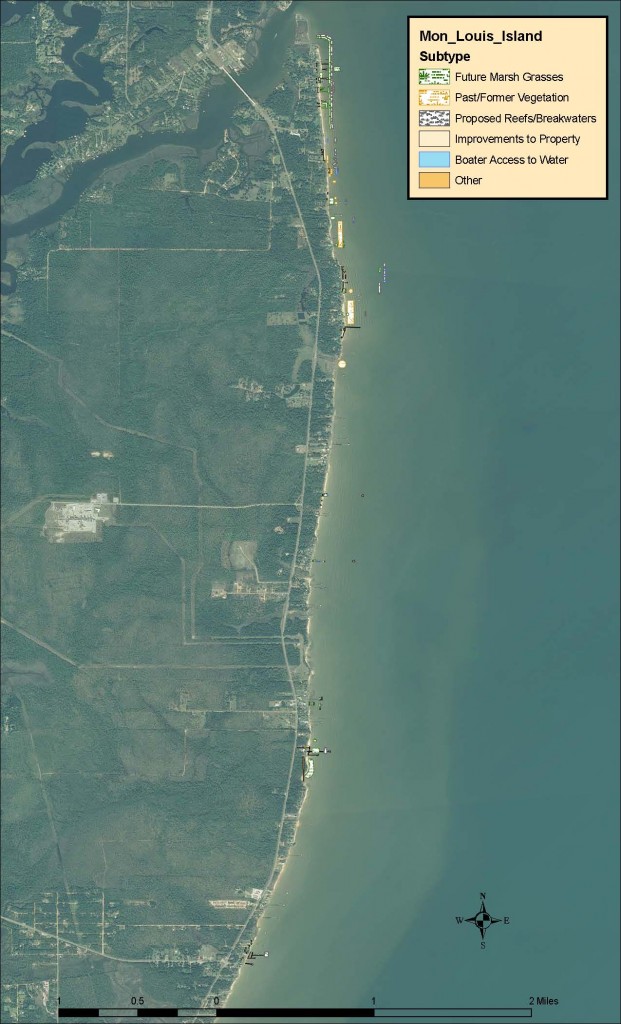
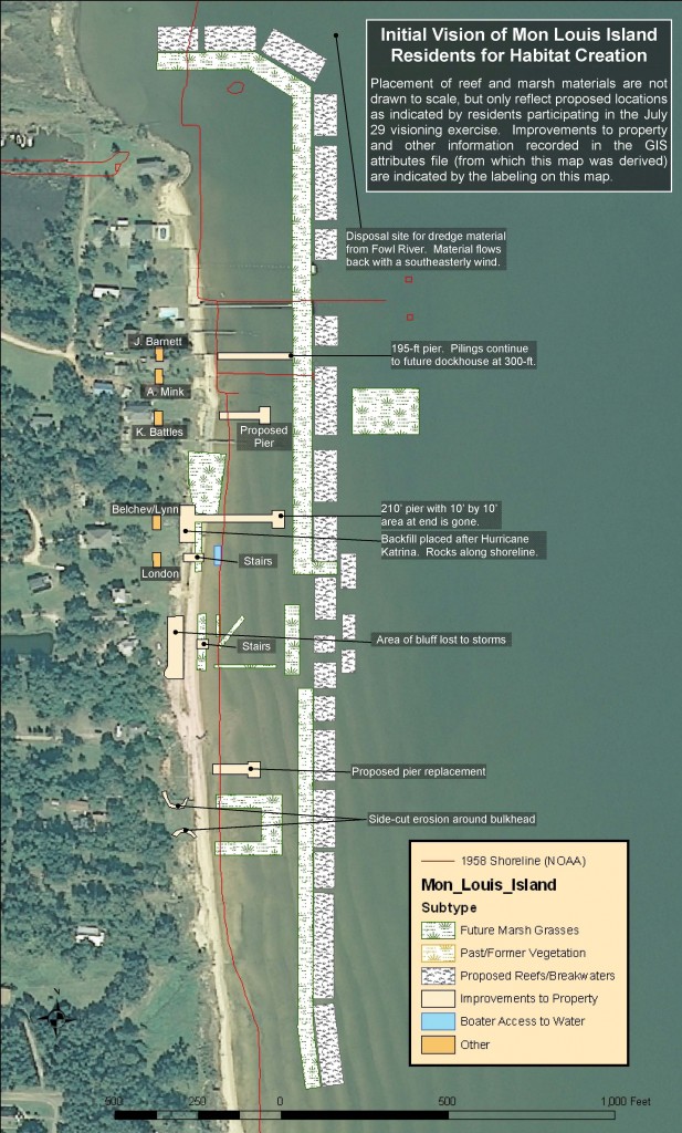
The second meeting was held on July 29, 2010 at St. Rose of Lima Parish Hall with 45 residents in attendance. Using maps of the approximately six miles of shoreline scaled to one inch = 25 feet, residents were asked to develop and draw a vision of how habitat could be restored or enhanced seaward of their properties. Homeowners were asked to consider several factors, including boater accessibility to the Bay, existing structures that might affect any new habitat that is created, water depth profiles from mean high water to one meter depth, and any relevant historical information or documentation about the shoreline. Residents’ input was converted to GIS files which were applied to 2010 images of the shoreline. The resulting map that was produced is included for your information.
Future Steps for the Project
It is clear from the participation at the meetings that there is interest in beginning shoreline restoration efforts, especially toward the island’s northern tip. Given the large turnout of residents from that area participating, MBNEP has submitted a grant application to the NOAA/Gulf of Mexico Foundation Community-based Restoration Partnership Grant Program for a restoration project along approximately 1000 feet from the northern end of the island travelling south and has requested and received commitment from the U. S. Fish and Wildlife Service to include this project in their 2010-2011 Coastal Program Plan.
During the fall, Dr. Bret Webb of the University of South Alabama Department of Civil Engineering will be gathering data which will be used to refine project design. He will analyze bathymetry (water depths) and hydrological data (winds, waves, and water movement) from Fowl River to Cedar Point and historic sediment transport along the shore while studying structural wave attenuation.
In January, 2011, MBNEP will conduct a workshop with Dr. Webb and Mon Louis Island residents to develop the actual design of this pilot project using Dr. Webb’s data and feedback from the Mon Louis Island property owners. Once the project is underway in 2011, we will continue to monitor the restoration site and focus on three specific areas for long term study: water circulation patterns, wave modeling, and sediment transport and shoreline modeling. Each of these will help us better understand the impact of restoration activities on the site, and hopefully our findings will be used as a second phase of the project is set in motion.
We look forward to continuing our partnership with the Mon Louis Island homeowners to enhance fisheries habitat, resources, vital to coastal Alabama’s quality of life. If you would like to learn more about our efforts, please feel free to contact Tom Herder (therder@mobilebaynep.com) or Beth Walton (bwalton@mobilebaynep.com) or call 251-431-6409.