Impacted Watershed, Joe's Branch D'Olive
 This before and after photo to the right shows the erosion on a tributary of Joe’s Branch. Ashley Campbell with the City of Daphne sits on a boulder that fell off the wall of the stream after a storm last summer. The second photo shows a completed step pool conveyance in Anne Arundel County, MD. The restoration of the tributary of Joe’s Branch will resemble the Maryland project. Click on the image for a full size view.
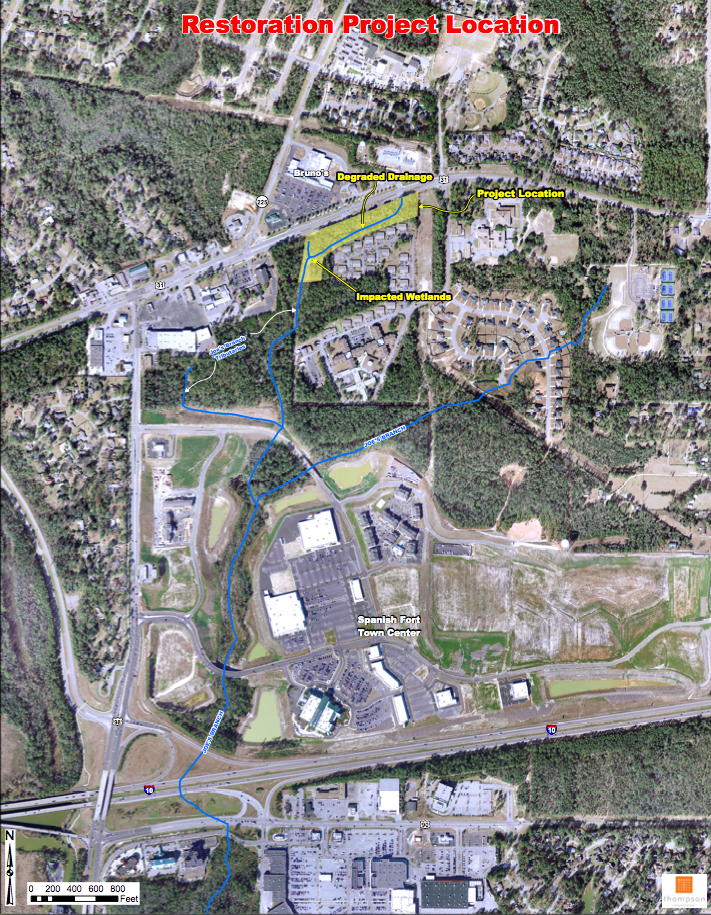
Restoration Location – the yellow area on the picture to the left shows the degraded drainage area that will be rehabilitated during this project. Click on the image for a full size view.
 The NASA charts to the right compare the change in land use from forested and agricultural to urbanization in the D’Olive and Joe’s Branch watersheds 1974 to 2008. Click on the image for a full size view.
.png)
The Step Pool Conveyance diagram to the left illustrates the proposed design of step pools to be built in a tributary of Joe’s Branch. Step pools are designed to slow the volume and velocity of stormwater flowing through the creek, decrease the runoff of sediment downstream, and improve water quality.
 The diagram to the right shows degraded streams and wetlands in the D’Olive Watershed.


