Western Shore
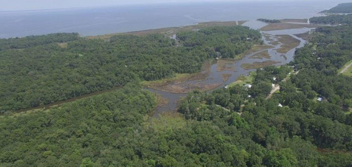
The Mobile Bay National Estuary Program (MBNEP) received funding from the National Fish and Wildlife Foundation (NFWF) Gulf Environmental Benefit Fund (GBEF) to develop watershed management plans (WMP) for several intertidal watersheds along the Alabama coast. The Western Shore Complex was identified as one of the priority watersheds and the MBNEP partnered with the Mobile County Soil and Water Conservation District to develop the Western Shore Watershed Management Plan.
This plan was completed in 2021 and is available to view or download by clicking the links below under Final Plan.
Registration - Mobile Bay Western Shore Property Owner's Meeting
The purpose of a Western Shore Shoreline Property Owner's Meeting is to initiate the development of a comprehensive shoreline management plan, a priority management measure of the Western Shore Watershed Management Plan.
Please complete the form below to help us better prepare for the meeting. Your information will remain private.
Final Plan
Latest Information
August 5, 2020: Thank you to everyone in attendance during last week's Mobile Bay Western Shoreline Assessment and Opportunities virtual community meeting. We hope the material was useful and informative regarding the western shore of Mobile Bay. In conjunction with Dr. Bret Webb and the MBNEP, we were privileged to facilitate the meeting to discuss the importance of the western shore and potential opportunities that could be integrated into the Western Shore Watershed Management Plan. If you were unable to attend, we have shared the recording of the virtual meeting using the link below. Following the sign-in page, the video will begin and can be viewed at your own pace. https://gmcplanning.com/WesternShoreline.
During the conclusion of the meeting, several questions were discussed that required additional follow-up. Below are those resources and responses:
- MASGC Living Shorelines Resources
- Living Shorelines Academy
- Living Shorelines: A Guide for Alabama Property Owners
- In response to the question regarding "How many 50-year return period events have we experienced in the past 10 years?" The answer somewhat depends on the exact location and the type of flooding or flooding source. However, in terms of "coastal flooding" we have experienced zero 50-year return period events in the past 10 years. However, we have experienced two 50-year flood events in the past 20 years (Hurricanes Ivan and Katrina). For reference, the 50-year return period coastal flood elevation is somewhere between +7 and +8 feet.
- We are also experiencing more frequent storms of lesser intensity. For example, we have had approximately three 10-year return period events in the past 12 years. On average, we should experience one 10-year return period event during a ten-year period. We seem to be experiencing about three times as many storms in an approximately similar period. Those storms were Hurricanes Ike (2008), Isaac (2012), and Nate (2017).
- Climate scientists and meteorologists somewhat agree on two points. First, we will experience the lower intensity storms (Tropical Storm - Category 2) more frequently than in the past. Second, the frequency of extreme events (Category 3 and higher) will go down, but those storms are likely to be stronger than in the past.
If you wish to be involved further with the Western Shore Watershed Management Plan process, which resulted in this virtual community meeting on the western shore, please visit the planning website.
January 15, 2020: Western Shore Story Map, click here to enter and Tell Us What You Think!
If you have questions about the Western Shore Watershed Management Plan or any related restoration efforts, please feel free contact us.
Latest News

Western Shore Shoreline Management Plan RFQ
The Mobile Bay National Estuary Program seeks a qualified environmental or natural resource planning...

Notice to Contractors: Re-Bid: Deer River Shorelin...
NOTICE TO CONTRACTORS: Sealed proposals will be received by Mobile Bay National Estuary Program (MBN...

MBNEP at work: Western Shore Watershed Management ...
Mobile Bay National Estuary Program announced this week completion and publication of its Western Sh...

Western Shore Community Meetings for Watershed Man...
FOR IMMEDIATE RELEASEThe Mobile Bay National Estuary Program (MBNEP) is seeking input and feedback f...

Western Shore StoryMap is Live!
The Western Shore Watershed Management Plan StoryMap is now live. ...


