The Landscape
Size Location and Land Use
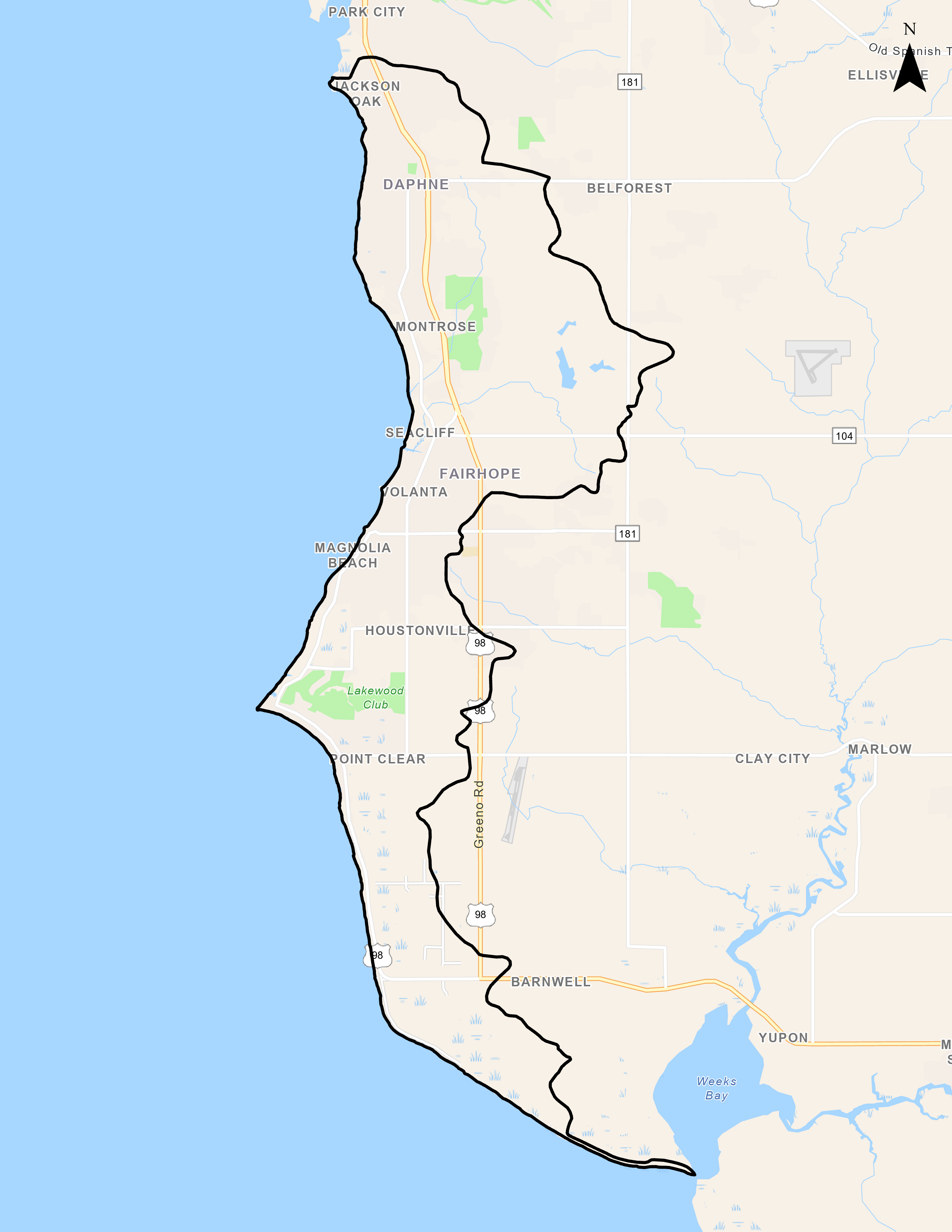
The Eastern Shore Watershed covers approximately 21900 acres along the eastern shore of Baldwin County and includes portions of the cities of Daphne, Fairhope as well as Point Clear and Barnwell. Land uses within the Eastern Shore Watershed have changed with increased population from an area that historically was dominated by forest and agricultural land to one that has experienced relatively rapid residential and business development, particularly along major transportation corridors and within subdivisions such as Rock Creek, The Woodlands, and The Waters. Land cover estimates for the Eastern Shore Watershed, based on the National Land Cover Database (2019) analysis were: 57% Developed, 26% Forest, 11% Wetlands, 4% pasture/grasslands, and 2% other.
Main Tributaries and Tidal Influence
The Eastern Shore Watershed (HUC 031602050205) has multiple sub-basins primarily draining directly to Mobile Bay. Primary named tributaries within the watershed include Yancey Branch, Rock Creek, Fly Creek, Point Clear Creek, and Bailey Creek.
Water Use Classification and Impairments
Fly Creek is classified for Swimming and Fish & Wildlife usage by ADEM. Fly Creek was listed on the State of Alabama's 303(d) list of impaired waters for pathogens (E. coli) in 2018 due to pasture grazing. Although no streams are listed for siltation, many of the tributaries within the urbanized portions of the Watershed have been significantly impacted by sedimentation and the streams exhibit many of the same issues found in D'Olive Watershed. Development has altered the habitats and increased volume and velocities of stormwater runoff have impacted the local waterways.
Human Uses
Public access to the waterways in Fly Creek exists at Bayfront Park (Daphne), the Fairhope pier and public beach, and at Pelican Point at the mouth of Weeks Bay. Additional private access points are available throughout the Watershed and include Fly Creek Marina and the Grand Hotel in Point Clear.
Ecological Importance
Previous investigations in the Watershed show than many streams within the urbanized areas have been severely affected by land use change and anthropogenic activities. Additional impacts associated with failing sanitary sewer infrastructure and runoff from agricultural areas have regularly introduced high levels of bacteriological pathogens into local streams.


