The Landscape
Watershed Size and Location
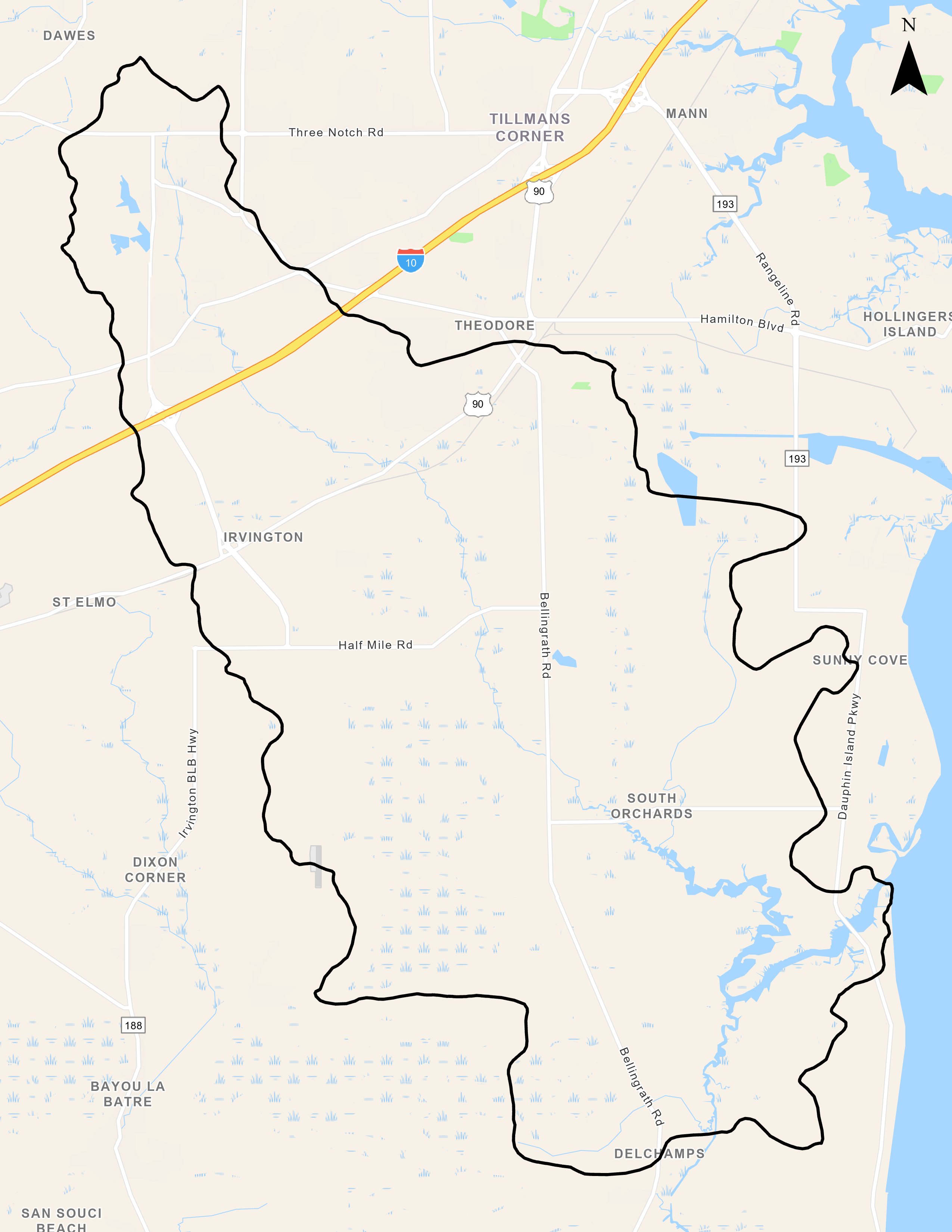
The Fowl River Watershed (HUC 031602050206) encompasses 52,782 acres, drains much of southern Mobile County, and is a direct contributor to Mobile Bay. Its headwaters are located near the Mobile suburb of Theodore, AL and it splits just south of Bellingrath Gardens into East Fowl River, which flows northeasterly into Mobile Bay, and West Fowl River, which flows south into Mississippi Sound. Land use in the Fowl River Watershed is varied and characterized as urban, residential, and rural. Twenty-one percent of the watershed area is classified as urban, 15% as crop or pasture land, and 63% as forested. Stakeholder concerns include loss of wetlands and shoreline erosion, largely related to recreational boat use. Increasing development and continuing erosion and sedimentation threaten water and habitat quality.
Main Tributaries and Tidal Influence
Fowl River has only two named tributaries, both of which are located in the central portion of the watershed. Muddy Creek originates east of Bellingrath Road, approximately two miles north of Laurendine Road (CR 24), and flows south for 4.5 miles to its confluence with Fowl River near Fowl River Road (CR 20). Dykes Creek originates less than a mile east of Muddy Creek, south of CR 24, and flows south for 2.5 miles to its confluence with Fowl River just south of CR 20. Due to its close proximity to Mobile Bay and the Gulf of Mexico, the lower portions of the watershed are tidally influenced. Based on field observations and water quality analysis from the Alabama Department of Environmental Management (ADEM), under normal conditions, tidal influence extends north from the mouth of East Fowl River past its confluence with Muddy Creek near CR 20. ADEM monitoring stations north of CR 20 have not detected tidal influence except under extreme conditions, such as excessive storm surge.
Impervious Coverage
Over the last decade, more attention has been paid to the effects of non-point source pollution as a significant contributor to water quality degradation. Of particular importance is the correlation between increased impervious surfaces (roads, parking lots, sidewalks, rooftops, etc.) and decreased quality of receiving waters. Studies show that impairment to streams occurs when the amount of impervious cover within a watershed exceeds 10%. A 2006 analysis of impervious surfaces within the watershed by the Alabama Department of Environmental Management (ADEM) indicated impervious surface coverage was approximately 8%.
Water Use Classification and Impairments
The Alabama Department of Environmental Management establishes the water use classifications for interstate and intrastate waters. Fowl River carries the water use classification of Swimming & whole body contact along its entire course. Since 2000, Fowl River has been listed on the 303(d) list of impaired waters for Mercury. A consumption advisory for largemouth bass (Micropterus salmoides) has been issued by the Alabama Department of Public Health for fish taken from Fowl River as a result of mercury concentration in samples collected from that watershed. Sediment samples taken by ADEM in the watershed didn’t indicate elevated levels of mercury or any other metals.
Ecological Health
The general ecological health of the watershed is good, which is supported by the diverse array of flora and fauna present. During ADEM’s 2006 watershed assessment they noted an abundant presence of wading birds, generally accepted to be indicative of the overall environmental health of a given area and indicators of ample food supply and suitable habitat.
Human Uses
Access to our coastlines is something that residents of the watershed and all of coastal Alabama greatly appreciate and is a primary value addressed under the MBNEP’s CCMP. Access to the waterways along Fowl River is primarily private with paid access available at the Pelican Reef Restaurant and where Fowl River Road crosses the river, at Memory’s Fish Camp. This river is a popular recreational boating and fishing location as observed from the number of small vessels that frequent it on a regular basis.


