The Watershed
A watershed is defined as a region or area bounded by a divide and draining ultimately to a particular watercourse or body of water. Each stream has its own watershed. Topography, or the configuration of the land, is the key element determining the watershed region. The boundary of a watershed is defined by the highest elevations that surround the stream. Drops of water falling outside of that boundary will drain to a different watershed.
Watersheds come in all shapes and sizes. They cross city, county, state, and national boundaries. Large watersheds are made up of many smaller sub-watersheds. In the continental U. S., there are 2,110 watersheds large enough to be “coded” by the U. S. Geological Survey; Hawaii, Alaska, and Puerto Rico bring the total to 2,267.
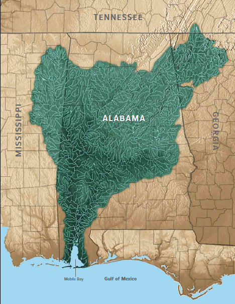
The Mobile Bay watershed covers approximately 65% of the state of Alabama and portions of Mississippi, Georgia, and Tennessee. Serving as a drainage system for 43,662 square miles, the Mobile Bay watershed is the sixth largest in the nation by area and at 62,000 cubic feet per second on average it has the fourth largest freshwater inflow on the North American continent.
The Mobile Bay estuary is the coastal transition zone between the Mobile Bay Watershed and the Gulf of Mexico.


