The Coast
Geology. Coastal Alabama has four physiographic subdivisions. The southern pine hills comprise the portions of eastern and western coastal Alabama with elevated or rolling topography. The alluvial plain, deltaic plain, and coastal lowlands are relatively flat. Coastal lowlands are adjacent to Mississippi Sound and extend along margins of Mobile, Bon Secour, and Perdido Bays. Alluvial and deltaic plains extend northward along the Tombigbee and Alabama Rivers. The coastal boundaries of these relatively shallow bays are defined by various barrier islands and spits. The Mississippi-Alabama shelf is a triangular area seaward of the barrier islands that extends from the Mississippi River Delta to the De Soto Canyon.
Coastal and offshore Alabama overlie sediments that range from pre-Jurassic to Holocene. These rock units are possibly more than 7,620 m (25,000 ft) thick at the coast and decrease southward by 1.9 to 9.4 m/km (10-50 ft/mi). The topography and sedimentation of the coastal and continental shelf result from tidal and current movements, as well as river discharge and delta formation and destruction.
The prominent structural geological features along coastal Alabama include the peripheral faults, Mobile graben, the Citronelle domal anticline, and the Wiggins uplift. Tectonic hazards are not a problem in coastal Alabama because there are no known active faults.
Oil and gas production is well established in coastal Alabama with developed fields at Citronelle, Chunchula, Hatter's Pond, and South Carlton. There is a high potential for future gas and oil production.
Coastal Alabama has a dynamic hydrologic system with the focal point of the system being the Mobile River and Mobile Bay into which it flows. Average yearly (fresh water) discharge from this system into the Gulf of Mexico is 50 billion cubic meters(12 mi3). Flooding is perhaps the worst natural hazard affecting coastal Alabama and may result from storm surges and heavy rainfall associated with hurricanes and other tropical storms. Flood discharge has a pronounced effect on inland and estuarine water salinity and coastal sedimentation.
Ecology. According to NatureServe, Alabama boasts the fifth highest species diversity among the fifty states and the highest of any state east of the Mississippi River. However, Alabama ranks second, following only Hawaii, in the number of species that are presumed or possibly extinct and fourth in the percentage of a state’s plants and animals that are at risk of extinction due to rarity or other factors.
Ecosystems may be classified according to the physical environment or dominant type of species present. Different habitats are commonly considered ecosystems, but many or most could more accurately be considered components of larger ecosystems. In coastal Alabama, local scientists and resource managers have identified habitats critical to sustaining the species diversity along the coast, including beaches and dunes, oyster reefs, SAV, intertidal marshes and flats, freshwater wetlands, maritime forests, pine savannahs, and long leaf pine forests.
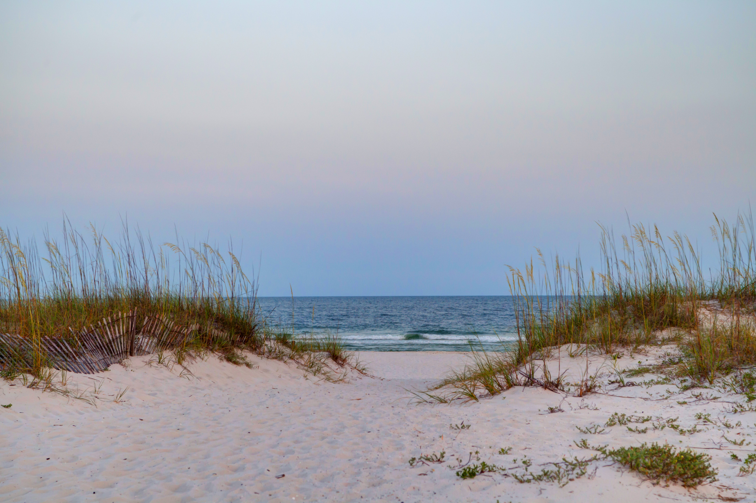
Beaches and dunes drive the economic engine that fuels the economies of the coastal region and the State. They also provide habitat for many shorebirds and other sensitive species and some level of protection for inland buildings. The main threat to the dune habitat is coastal development, but foot traffic and loose pets are also significant stressors.
SAV (Submerged Aquatic Vegetation) is commonly considered the “hallmark of a healthy estuary,” due to roles as nursery habitat and refuge for fish and shellfish, nutrient absorption, oxygen provision, and sediment stabilization. Distribution of SAV has declined dramatically in coastal Alabama over the last 60 years. Only 31% of acreage documented in 1940, 1955, and 1966 in the MBNEP study area appeared in 2002 imagery. While some local increases were noted in 2008 and 2009, an additional 1,300 acres were lost over that six- to seven-year period. Stressors include sedimentation from stream bank erosion and dredging, nutrient over-enrichment, scarring from boat propellers and even pressures related to selective fishery harvest.
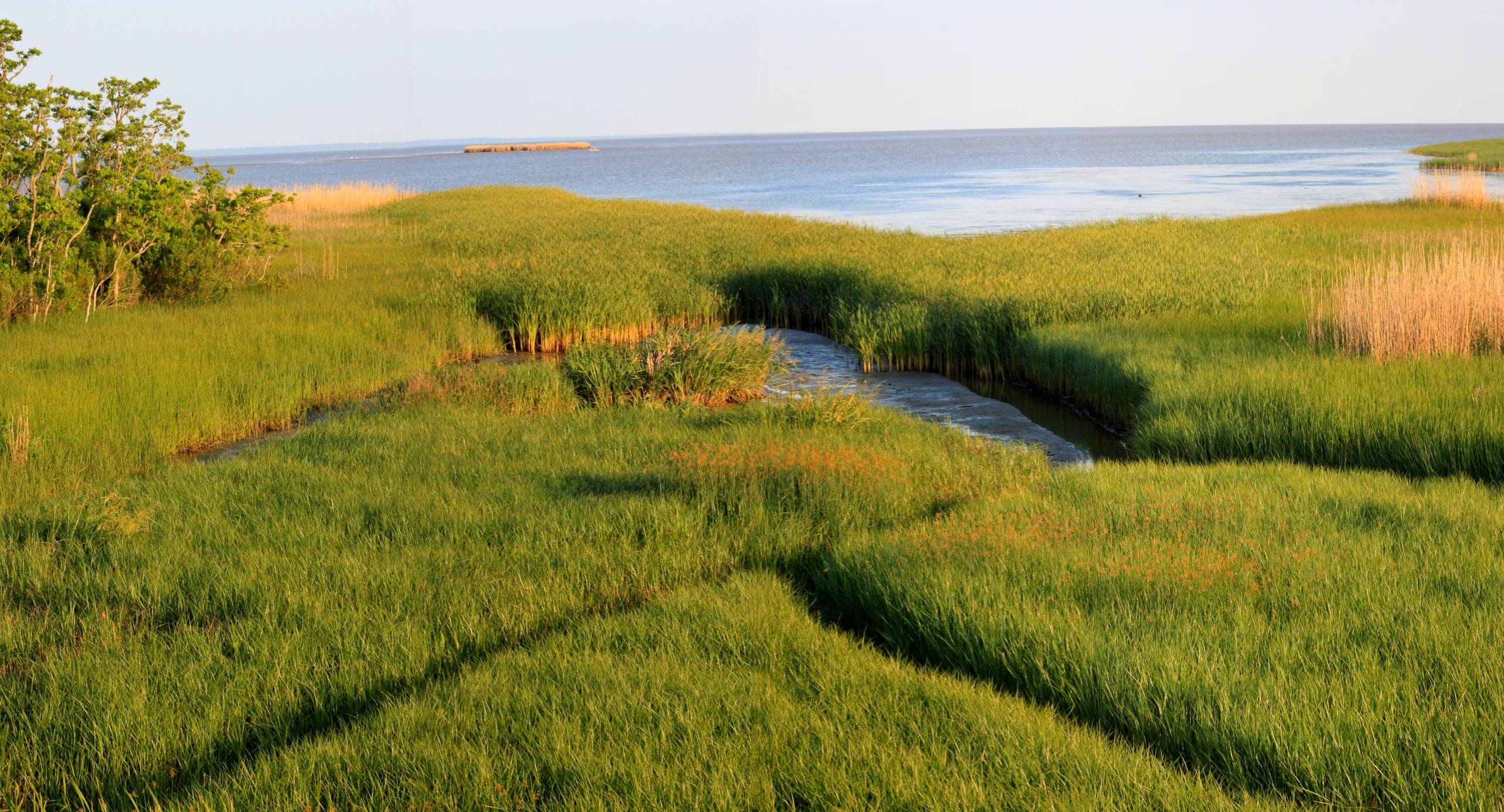
Wetlands, whether freshwater or salt marsh, provide a host of valuable ecosystem services, including providing complex habitats that support a diversity of species, filtration of nutrients and pollutants, shoreline and sediment stabilization, and protection of upland areas from flooding and storm energy. Gulf coast wetland loss (and especially that of the state of Louisiana) has been far more dramatic than in other American coastal watersheds. The U. S. Fish and Wildlife Service estimates that over half of Gulf wetlands were lost between 1780 and 1980, and almost 400,000 acres of freshwater wetlands disappeared from Gulf watersheds between 1998 and 2004. Over the last four decades, Alabama has experienced wetlands loss at four times the national average. While a significant loss is attributed to hurricanes, storms, saltwater intrusion, and sea level rise, human activities such as construction and development, installation of oil and gas infrastructure, and logging have also contributed to this problem.
Locally, the decline of oyster reef habitat has been related to climate influences. Persistent drought conditions and increased seawater flow through the Katrina-generated cut in Dauphin Island have increased the salinity of existing oyster habitat, providing conditions favorable for oyster drills, which have decimated the oyster fishery. Like SAV and salt marshes, oyster reefs provide exceptionally complex habitat that provides food and refuge for a diversity of species. Since each oyster is capable of filtering over a gallon of water an hour, they contribute to improving water quality, especially when populations are healthy.
Like previously mentioned aquatic habitats, maritime forests, pine savannahs, and long leaf pine forests support the diversity of birds, mammals, reptiles, and other upland wildlife species which contribute to our state’s exceptional biodiversity and our outdoor-centered quality of life. Development pressures and fire suppression are examples of the human-related stressors that have fragmented and eliminated much of these productive habitats. Long leaf pine forests covered 90 million acres of the American southeast when Europeans settled the land. Less than five percent still exists, supporting species diversity that rivals the most productive of earth’s ecosystems, including threatened and endangered species like the red-cockaded woodpecker, indigo snake, gopher tortoise, and many rare plants.


