The Landscape
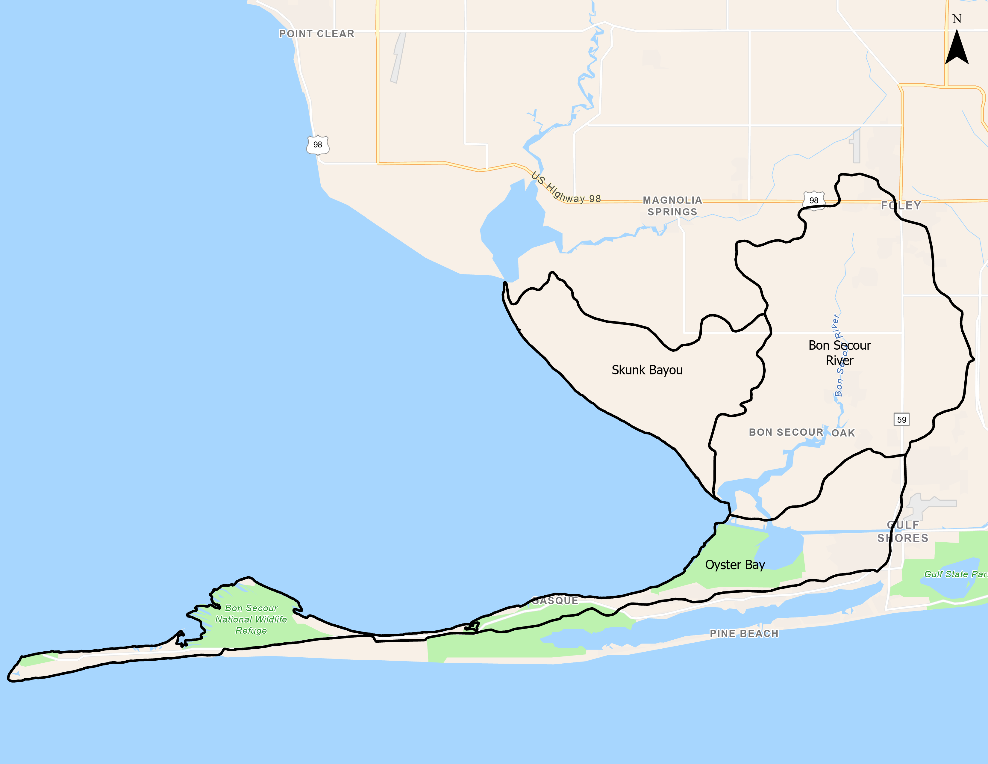
Watershed Size and Location
The Bon Secour River Watershed covers over 21,400 acres in southwest Baldwin County. The Bon Secour River originates in the City of Foley and flows southwesterly into Bon Secour Bay, the Intracoastal Waterway, and Oyster Bay. Total land use breakdown: 5% urban, 64% agricultural land, 22% pasture land, 6% forested, 2% water/wetlands.
Main Tributaries and Tidal Influence
Bon Secour River (HUC 031602050310) is approximately 8 miles long and receives drainage from numerous small tributaries. Of these, only Boggy Branch, Bright's Creek, Shutt Creek and Miller's Bayou are considered to be navigable by small watercraft. All areas are tidally influenced.
Water Use Classification and Impairments
ADEM's water use classifications within this watershed include Swimming & Whole Body Contact and Fish & Wildlife. An unnamed tributary to the Bon Secour River was placed on the 303d list for pathogen contamination in 2008 and a TMDL was developed in 2009. In addition, Bon Secour River was placed on the 303d list for mercury (atmospheric deposition) in 2008 (TMDL scheduled for 2020). Although agriculture accounts for the predominant land use based on National Land Cover Dataset from 2001, that is beginning to change as crop and pastureland have begun to transitions to urban/suburban residential and commercial developments. The TMDL lists agricultural and storm sewer runoff as the likely sources of pathogen loading.
Human Uses
Commercial fishing was the primary driver of the basin's economy during the 19th and earl 20th century. Today, fishing and seafood processing in Bon Secour ranks among the top twenty US ports, with shrimp, oysters and blue crab accounting for the most important species landed. There is very little in the way of public access within the watershed, with only private access boat ramps, boat docks, and marinas.
Ecological Importance
Although the watershed is predominantly rural and possesses a minimal amount of industrial development, the effects of stormwater runoff, erosion, siltation and other problems related to nonpoint sources were observed to have significant impacts on aquatic habitats within the watershed. This watershed also has a significant amount of waterfront development and shoreline alteration, with large areas of bulkhead replacing natural shoreline cover. The sampling of benthic invertebrates by ADEM indicated low species diversity, which was considered to be indicative of land use disturbance and siltation within the watershed. A considerable amount of wetland and intertidal marshes are still present within the watershed as well as a significant amount of pine savanna. USFWS documented T&E species: Florida manatee (Trichechus manatus latirostris), Gulf sturgeon (Acipenser oxyrinchus desotoi), American bald eagle (Haliaeetus leucocephalus).


