The Estuary
Estuary (ĕs’chū-ĕr’ē) – a partially enclosed coastal body of water, having an open connection with the ocean, where freshwater from inland is mixed with saltwater from the sea. Estuaries represent some of the most sensitive and ecologically important habitats on earth. They provide sanctuary for many species of waterfowl, store nutrients for larval and juvenile marine life, and serve as breeding grounds for many desirable species of marine life. Since estuaries commonly provide excellent harbors, most of the large ports in the United States (New York, Philadelphia, Baltimore, Mobile, Galveston, Seattle, and San Francisco) are located in estuaries. However, the development of high-density population centers causes deleterious effects that can destroy the very properties of the estuary that made the development of the region possible. Human impact on estuaries includes reclamation of tidal land by filling; pollution from sewage, solid waste, industrial effluent; increased sedimentation in the estuary; and alteration of the salinity of estuarine waters by withdrawal or increased influx of freshwater.
Alabama’s estuaries are considered environmentally and economically important because of their exceptional biological diversity and productivity. These estuaries, where the fresh water from several rivers meets the salt water of the Gulf of Mexico, support both fresh and saltwater species and serve as nursery habitat for many commercially and recreationally important fish and shellfish.
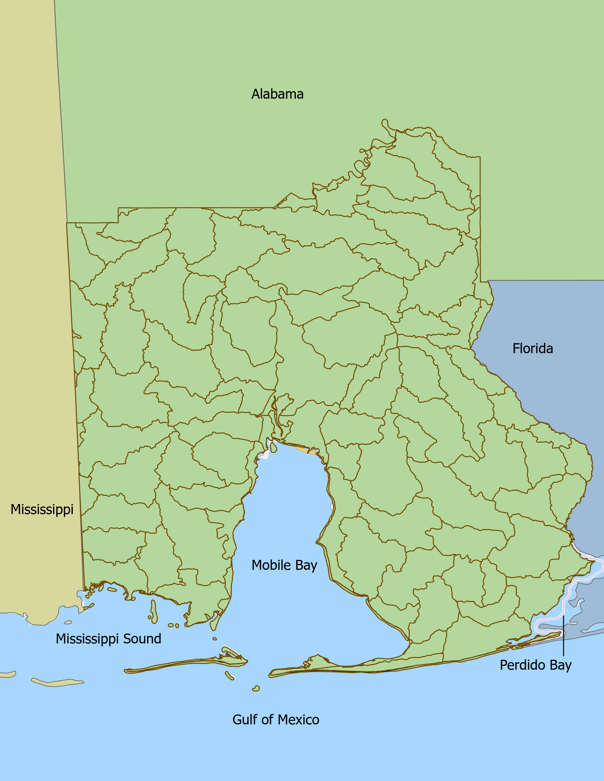
The Mobile Bay Estuary includes waters within Baldwin and Mobile Counties and Mobile Bay. This estuary is greatly affected by upstream waters that flow into it from the expansive Mobile Bay Watershed. Other coastal estuaries in and near Alabama include Mississippi Sound westward to the Alabama-Mississippi State Line, Perdido Bay, and their tributaries. The Mobile Bay National Estuary Program service area includes all of Mobile and Baldwin Counties, as well as Alabama State marine waters in the north central Gulf of Mexico, extending three miles south of Dauphin Island and the Fort Morgan Peninsula. The Mobile Bay National Estuary Program study area is shown on the map above.


