The Restoration
With a Comprehensive Management Plan for the D’Olive Creek, Tiawasee Creek, and Joe’s Branch Watershed completed in August 2010, partners are making progress towards implementing measures recommended to address the primary problems impacting its 23 miles of streams and downstream receiving waters. This 7,700-acre watershed includes portions of Daphne and Spanish Fort and has been plagued by excessive erosion and sedimentation since the early 1970s. With steep, hilly terrain; sandy, erodible soils; hardened, developed surfaces; and, on average, five and a half feet of hard rainfall annually, the D’Olive Watershed presents “the perfect storm” of stormwater impacts. All three principal streams and two unnamed tributaries appear on the State’s 303(d) List of Impaired Waters Bodies for siltation and habitat alteration (from development).
Critical Issues and Areas
Increased volume and velocity of stormwater runoff and changes to local drainage patterns have escalated concerns over erosion and sedimentation within the watershed stream network, Lake Forest Lake, D'Olive Bay, and Mobile Bay. Urban development transforms the natural landscape into hard surfaces (i.e. rooftops, roads, and parking lots), collectively referred to as "impervious cover." Based on the intense growth experienced in this region, a 100% "build-out" condition, with essentially all presently undeveloped land converted to commercial or residential land uses, could be reached by 2020. The identified critical issues and areas for the watershed are:
Urban Development
Stormwater Runoff
Streambank Erosion
Sedimentation
Wetlands Degradation
Lake Forest Lake Shoaling
Invasive Species
Recommended Management Measures
Without more effective stormwater management, the projected level of growth within the watershed will continue to worsen stream conditions, and greatly constrain potential future stream restoration efforts. Because ongoing stream channel degradation problems are made worse by each significant rain event, timely action is critical. By successfully addressing excessive storm water runoff and the sedimentation that it causes, the long-term health of the streams, wetlands, and bays will be recovered. The Watershed Management Plan consists of three components that should be implemented concurrently:
- Repair Immediate Problems - restoration of streams and wetlands and Lake Forest Lake.
- Strengthen Regulatory Controls - additional requirements for stormwater best management practices, land development regulations (zoning ordinances), potential "overlay districts" for stormwater quality improvements.
- Restore Watershed Hydrology -
- Stormwater retrofits for existing developed areas
- "Smart Growth" concepts for new developments
- Land use planning
- "Green Streets" concepts
- Forest preservation
- Rainwater harvesting (cisterns, rain barrels, rain gardens)
- Bio-retention areas
- Regional stormwater facilities
- Preservation of green space
- Preservation/restoration of riparian buffers
- Alternative vegetation management
Recommended Project/Program Prioritization and Cost Estimates
Implementation Strategy
Successful implementation of the management measures presented in the WMP will require that a diverse array of implementation strategies by employed. These strategies will involve all levels of stakeholders within the Watershed.
Recommended Implementation Schedule
Monitoring
To track the long-term success or failure of restoration activities in the D’Olive watershed substantial resources have been allocated to monitor sedimentation and flow, water quality, habitats, and wetlands. Comprehensive monitoring in the D’Olive watershed also enables calibration of a Biological Condition Gradient (BCG) model for the larger Mobile Bay Estuary. The BCG model will be used to assess and communicate to the public the health of the estuary, using biological information and stressor assessment to measure estuarine status and trends. To ensure a standardized monitoring protocol for watershed restoration and watershed management plan implementation across all coastal Alabama watersheds, the Mobile Bay National Estuary Program tasked their Science Advisory Committee with the development of a comprehensive monitoring framework. Related D’Olive publications can be found in our library.
Completed Projects
Joe’s Branch Subwatershed
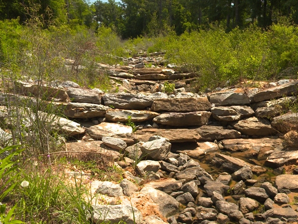
Joe's Branch Step Pool | Photo by Gulf Guardian
Joe’s Branch Tributary JB Step Pool Stormwater Conveyance
In 2011, collapsing banks along an ephemeral (only wet after rains) Spanish Fort tributary on Westminster Village property threatened residences and Highway 31 and delivered an unprecedented 100,000 tons of sediment per square mile into Mobile Bay. MBNEP secured Clean Water Act Section 319 funding to construct a rock step pool conveyance over a sand infiltration matrix down the steep 1,000-foot slope to reduce stormwater energy and volume. Southern Excavating was contracted to implement this Thompson Engineering design. This successful restoration project won a 2015 Gulf Guardian Award for Partnerships and survived April 29, 2014, 500-year rain event.
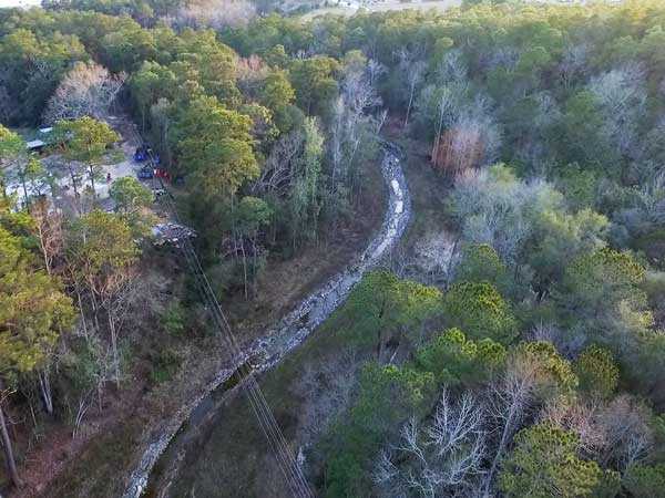
JB2 Restoration Feb. 2017 | Photo by MBNEP
JB Project 2
With funding from a National Fish and Wildlife Foundation Gulf Environmental Benefits Grant for comprehensive restoration of the most critically-degraded streams across the D’Olive Watershed, a head cut advancing towards the toe of the step pool conveyance and threatening sewer infrastructure was the next project to be addressed. Thompson designed hybrid measures, including elevating the stream bed, expanding the flood plain, using rock to stabilize stream banks, and installing rock weirs and energy dissipating log structures. This project, constructed by North State Environmental and including restoration of 1,700-linear feet of stream and eight acres of wetland and flood plains, was substantially completed in August 2015. Of note: GSA sampling indicates that the Step Pool Conveyance and JB Project 2 were successful in reducing sediment loads by over 90%.
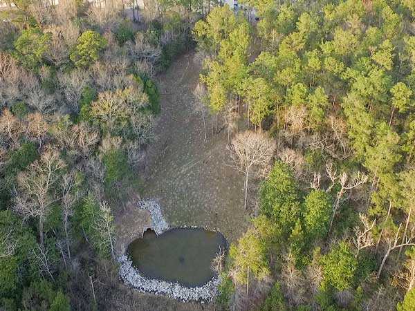
JA Restoration (Piggly Wiggly) | Photo by MBNEP
Stream tributaries J4-1, J4-2, and JA and JB and J Stormwater Management Facilities
Designed by Thompson Engineering and currently under construction by Southern Excavating, remaining tasks to be funded by NFWF GEBF in this sub watershed include:
- Repair/restoration of an existing detention basin on the property of Westminster Gates to original storage capacity (J SWF).
- Construction of a new detention basin (JB SWF) on the Alabama Power easement at Westminster Village immediately upstream of the Step Pool Conveyance.
- “Green” restoration of two incised stream segments (J4-1 and J4-2) of the main stem of Joe’s Branch downstream of J SWF along with the relocation of an existing sewer line.
- Restoration of the degraded, rock-reinforced tributary JA behind the Piggly Wiggly. Water will be piped down the steep slope, which will be restored to provide ecological services, to a splash pad and wetlands to reduce energy and improve water quality prior to its confluence with the main stem of Joe’s Branch.
Tiawasee Creek Subwatershed
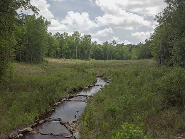
Tiawasee Creek Restoration | Photo by MBNEP
Tiawasee Creek Restoration
Managed by the City of Daphne and co-funded through a Daphne Coastal Impact Assistance Program Grant, MBNEP’s NFWF GEBF Grant, and a State CWA Section 319 Grant, restoration of this 1,400-foot-long Tiawasee Creek segment TC1-TC2, near the corner of Park Drive and Pollard Road in Daphne, is nearing completion. Designed by Goodwyn Mills Cawood and constructed by North State Environmental, restoration involves excavation of a new and wider flood plain, relocation and elevation of the stream bed, installation of rock and log energy dissipating structures, and headwater wetland restoration.
D’Olive Creek Subwatershed
Tributary D4-D6
Abutting and downstream of Interstate 10 near Mile Marker 37 on property owned by Malbis Plantation, has been the target of at least two previous restoration attempts, both of which were “blown out” by significant rain events. ALDOT is completing Volkert-designed stabilization of the box culverts and the splash pool, as Goodwyn Mills Cawood works to tie that project into the 100% stream restoration design. The design includes expanding the flood plain across a 30-acre footprint, elevating the streambed, and installing in-stream energy dissipating structures. The project is currently being advertised for bids and is expected to go to construction in early May 2016.

3/8/2016 - Pre-Construction | Photo by MBNEP

7/8/2016 | Photo by MBNEP

12/12/2018 | Photo by MBNEP
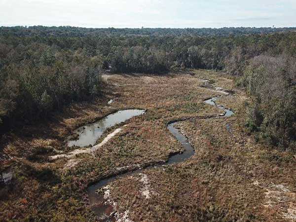
12/12/2018 | Photo by MBNEP
Tributary DA3
Also on Malbis Plantation land and east of County Road 13 in Daphne, is currently under early phases of design by a Volkert team. The project area includes several incised braids (totaling ~1,000 linear feet) through degraded wooded wetlands upstream of a small-scale step pool project implemented by the City of Daphne a decade ago. Restoration will include elevating the streambed and construction of two detention ponds. The design will be completed in late 2016.
Tributary DAE
Restoration of Tributary DAE, involving less-than-1,000-feet of a severely head cut reach with a particularly small drainage area running north to south and splitting two property parcels in the Oakstone neighborhood south of Highway 90 and west of County Road 13. The restoration was designed by AMEC/Foster Wheeler.
Tributary DAF Restoration
Restoration of Tributary DAF, directly downstream of and across County Road 13 from DA3 is being designed by Hatch Mott MacDonald. Both the 1,200 linear foot main stem and a 400-foot degraded tributary originating near the Lake Forest Golf Course will be stabilized and restored, along with three acres of wetlands. Discussions are in progress with property owners as delivery of the 100% design is expected later in 2016.
Monitoring and Research Studies
- Sedimentological Study of D'Olive Bay and its Drainage Basin 1981
- Joes Branch Post Restoration Assessment 2014
- Joes Branch Post Restoration Monitoring 2014
- Monitoring Sites, Restoration Areas, and Land Use/Land Cover for Joe's Branch
- D'Olive Monitoring Summit Report 9-18-2015
- Joes Branch Post Restoration Assessment
Publications
- Analysis of Sediment Loading Rates and Impacts of Land-use Change on the D’Olive and Tiawasee Creek Watersheds, Baldwin County, Alabama (2007)
- Comparison of Land Use/Land Cover for D’Olive Watershed, (1974-2008)
- D’Olive Watershed Wetlands Condition Assessment, Vittor & Associates (2010)
- D’Olive Bay, Ecological Consequences of Channel Dredging (DISL, Vittor 1972)
- D’Olive Bay, Phase IV of Ecological Consequences of Channel Dredging, (DISL, Vittor 1973)
- D’Olive Creek I-10 Assessment
- Daphne LID Project Final Report
- Daphne Village Point Invasive Species Management


